
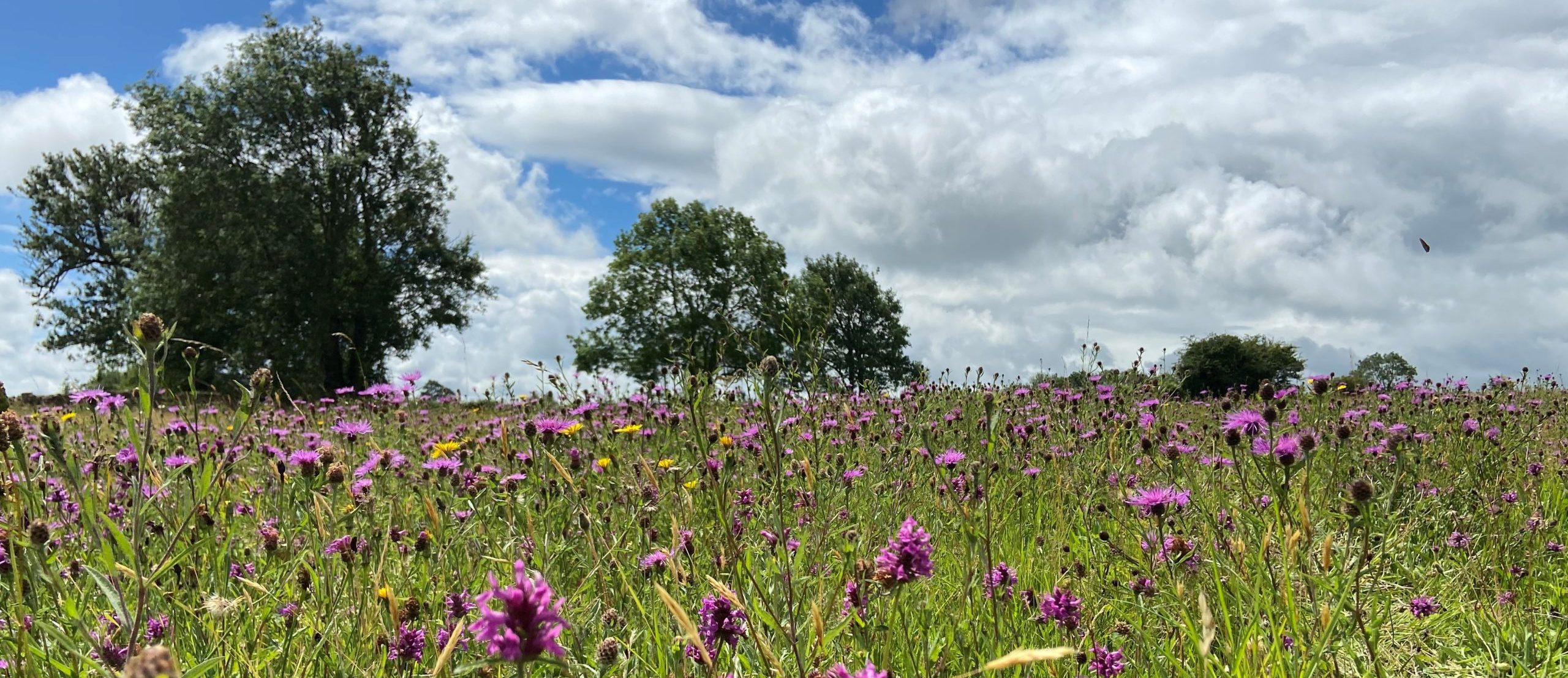
A healthy and thriving wildflower meadow – a great example of nature and habitat recovery. Photo by Anna Field.
What is the Cotswolds Nature Recovery Plan?
Adopted by the Board of the Cotswolds National Landscape as guidance in October 2021, the Cotswolds Nature Recovery Plan (CNRP) was developed in partnership with the Cotswolds Nature Recovery Forum. It is a deep dive into the species and habitats of the Cotswolds, and what we can all do to help them flourish and spread across the landscape.
A concise Farmer and Land Manager Version has also been produced.
How the plan was developed
This plan represents a broad consensus from across the Cotswold’s conservation and land managing community. Over 218 individuals representing over 75 organisations were consulted on the plan, and a workshop was held for an invited group of farmers and land managers. Participants were selected to represent a variety of farm types, scales and extent of current engagement in nature recovery.
How to use the plan
The contents of the plan are flagged with icons for three broad audiences: farmers and land managers, policy makers and fund holders, and individuals and communities. These icons will direct people to the parts of the plan most appropriate for them. A more concise, tailored version has also been produced for farmers and land managers.
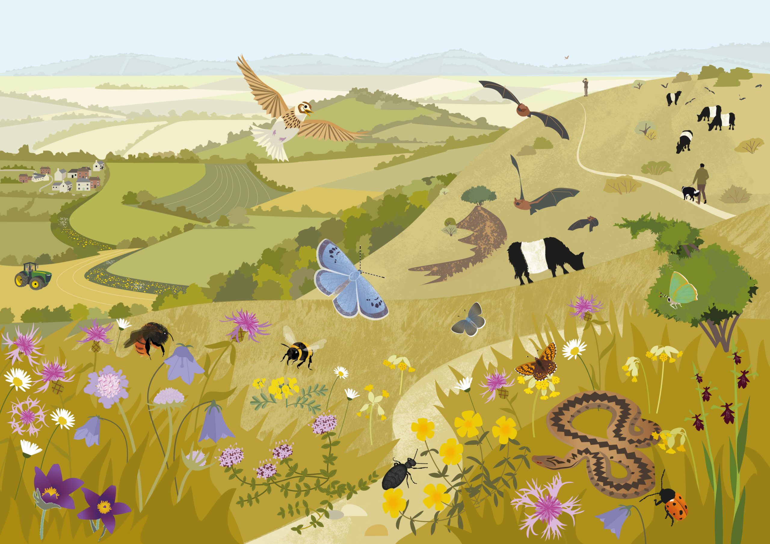
An illustration of how nature recovery could help species and habitat diversity flourish in the Cotswolds. Illustration by Rachel Hudson, with thanks to Back from the Brink/Butterfly Conservation.
Commissioned images
Three pairs of images showing views of Cotswolds landscape types with – and without – nature recovery measures have been commissioned, to illustrate the impact this plan is seeking to help deliver. As well as being included in the plan, they have also been produced as standalone images to help promote the plan’s key messages.
These images show views of:
Mapping
A Natural Capital Evaluation of the Cotswolds National Landscape was undertaken in May 2021 as a pilot project with funding from Natural England, sourced by the National Association of Areas of Outstanding Natural Beauty. The results can be examined through a bespoke dashboard.
The Natural Capital Evaluation looks at a range of issues important to the Cotswolds including: habitats, nature recovery, carbon storage, farming, water flow regulation, and water quality regulation. This is the first time this data has been consistently analysed across the whole Cotswolds National Landscape area. Such a complete Cotswolds landscape-focussed approach is rare due to the number of local authority and regional boundaries involved.
This powerful tool allows data already publicly available to be investigated at different scales, whilst automatically presenting graphs, maps, and tables – and calculating areas by landscape character area and designation.
A side bar on the left hand of the screen can be clicked on to bring up a brief explanation of the data presented, along with the methods used and a document with further detailed explanations which can be downloaded from the technical specification page.
Natural Capital Evaluation and CNRP
The mapping within the dashboard forms part of the Cotswolds Nature Recovery Plan. The habitat data was used to create a baseline for setting targets for the new habitat extents, and the opportunity maps within the nature recovery page reflect the priorities within the plan. All the maps can be investigated down to the level of individual fields. The opportunity maps in particular can inform local decision making to best support nature recovery. They can be viewed as recommendations.
Many of the Local Authority or Local Nature Partnership areas coincident with the Cotswolds National Landscape have also undertaken nature recovery opportunity mapping, and where these were available at the time of publication they have been included within the plan. Although based on similar data and methodologies, there will be differences that may lead to variations in some results at the field level.
The dashboard does not cover all considerations necessary for making decisions and it is important to also look at:
As a pilot project, both the Natural Capital Evaluation and the dashboard used to present it are, to a certain extent, experimental. Similar work may be undertaken again to monitor the Cotswold Nature Recovery Plan’s progress, so we would be grateful if any observations or suggestions for improvements are sent to: simon.smith@cotswolds-nl.org.uk